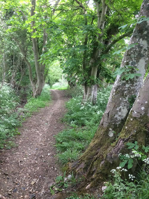
This is a circular route around the village of Brockley and has the proud distinction of never visiting the village of Brockley. The 7 mile circuit makes use of the Bury St Edmunds to Clare long distance walk in the north/south direction and an old green lane cum bridleway in the south/north direction. There are sufficient undulations and views and variation to make life interesting without providing too much of a struggle. Most of the circuit is either on field edges, or tracks, or through grassy meadows or bridleways but there is one short cross-field section towards the end. In the middle of January this was very sticky. For reassurance take your copy of Ordnance Survey Explorer map 211 Bury St Edmunds and Stowmarket with you.
Upper Somerton is on top of the hill a mile or so due west of Hartest. It is a cul-de-sac village where the main street just stops at the far end. Park on the grass in front of the church. Turn west and head towards that dead end. In the little notice board on your left you may notice the appealing Ode to Somerton. This reads
We’re top o’ the hill where the wind do blowy
We’re nice and quiet and we’re not too showy
We love to see you, but m’deary don’t you knowy…
When you come to Upper Somerton you must drive slowy!
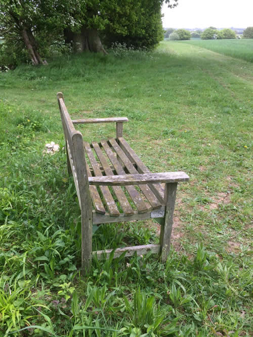
Just past the last of the houses the view will open up and you have to choose from three possible footpaths. Take the rightmost and head downhill along a lane towards a house. As the road curves left and at the bottom of the dip, you will be faced by further choices. Turn right through a small copse and head uphill with a hedge on your left. Waymarks are present (plus a ‘No Horses’ sign) and in fact waymarking is good on most of this walk. At the top of the hill a hedge appears on the right and soon after there is a footpath junction. Ignore the turning right and continue ahead. After passing a garden on the left, go left and right beside a flint and brick open front building (waymark). Follow this green track between ponds (there was an impressive display of snowdrops in early February) first with a hedge on your left and then with a hedge on your right, going steadily downhill. At the bottom of the dip take a sharp left (there is a 3 direction fingerpost at this junction) and head uphill, again with a hedge on your right. Go through a gap and after a short open section with a ditch on your left the hedge changes sides. It will remain on your left until you reach the road. Turn right and take the next fingerpost (restricted byway) on the left. After going through a gap this field edge path continues beside a ditch and an intermittent hedge through several corners until reaching a quiet country lane. Turn left for a short distance until you come to a byway on the right beside a belt of trees. Take this and shortly turn left uphill at a footpath junction keeping the hedge on your right. Where the hedge ends you must continue ahead on a short open stretch but before doing so you may wish to take a breather. If so there is a seat in a sheltered corner of the field to your right overlooking the village of Hartest.

This seems to be a generous contribution by the landowner and is regularly used by locals. Turn left at the far side (waymark) of the open stretch and walk for someway still with a hedge on your right. Go through a gap to join a sunken lane which doubles as a stream in very wet weather. Just as you start to get worried you will find a footbridge on the left which crosses the stream proper. This is the escape route. Cross the footbridge and follow the green lane/byway all the way to farm buildings. Join a road for a very short distance and immediately after the ‘Tuffields Road’ sign take the path going left over a narrow sleeper bridge. Follow the edge of a large garden containing a moat and a mound and a timber clad house. This narrow, enclosed path leads to a corner. Turn left and follow the direction of the waymark between a hedge on your right and pines and ponds on your left. Arrive at the top of a narrow field which is used for storage of farm machinery. Head downhill with the hedge on your right. Where the hedge stops continue in the same direction for 50 paces to reach a waymark in the corner. Turn right now with a hedge and stream on your left and head for a stile in the next corner. This leads you into one, and then a second, old fashioned meadow. Exit the second via a five-bar gate to reach the road. You now have to walk for a quarter mile along the Bury St Edmunds to Hartest road and at certain times of the day this can be quite busy. There are verges both sides of the road but they are narrow in places.
(It is possible to avoid this road section by squeezing between the railings of Brockley Cricket Club and following the left-hand edge of the ground and a small arable field to reach a footpath at the far side. Turn right to reach the church*. PLEASE NOTE that apart from the footpath this diversion is not an official right of way)
At the next fingerpost on the left take the leftmost option and head across Pound Green towards the church*. Cross a footbridge and go round two corners and through a gap in the hedge to reach the churchyard. The church is usually open. To the south of the chancel is the base of a preaching cross which an early C19 rector moved from the nearby meadow. In ancient times, when the churchyard was a gathering place, market and fairground, most churches had a preaching cross from which the resident priest or wandering friars would preach to the assembled people.
Leave the churchyard via the pedestrian gate on the right and make a right turn, cross a brook and reach the main drive. Turn left. Within 150 paces you should have large barns to the right and left and the Bury St Edmunds to Clare long distance path joins you from the right. This route has its own waymarks and you will follow these all the way to Somerton. Continue ahead to follow a rather humdrum mainly concrete farm track, uphill at first but then levelling out. This is probably the least interesting section of the whole circuit which is surprising as its part of an official long distance trail. Eventually you will reach a group of buildings’ including a neglected house. and a yard. On 10th May 2020 there were no signs at this point. You need to veer left through a gap in the hedge and follow the ditch on your left dotted with occasional ash or oak tree. Cross a footbridge and turn right with a ditch now on your right. Reach a quiet country road and turn right. Just past buildings on the left (Drivers Farm/Brittons Farm) obey the fingerpost pointing left, which shows Somerton to be 1 mile ahead. Walk beside the fence, around a diverted kink to reach a fingerpost. This next section is the only cross field path on the whole of the circuit and is short. Go ahead along tractor tracks to find the start of hedge running down a slope. Keep to the left of the hedge and walk on a grassy field edge into a second field and beside a brook into a green lane. Follow the track through farm buildings and in front of the farmhouse to pick up the drive which curves uphill and back to Somerton church.
Roger Medley
First walked 4 February 2011
Re-walked 10 May 2020
This series of walks have been put together by Roger Medley.
If any of the walking notes are confusing or inaccurate or the information is wrong, please contact Roger on 01440 820551. If they are helpful, or if you have any other comments, likewise.
Coming Soon to a Fingerpost near you
Suffolk County Council has received funding for a county wide initiative to encourage more people to explore the local area. A field officer has been appointed and volunteers have been recruited to attach plaques to fingerposts in individual parishes. Each plaque (see diagram) displays an app. which can be downloaded to modern Apple and android phones. This will display the local section of the Ordnance Survey map showing footpaths and recognised walking, cycling and riding trails. The information can be stored if walkers are visiting an area where there is limited phone cover. Plaques have been added to 44 stable fingerposts in Wickhambrook and where fingerposts are missing or unstable these have been reported. There are 18 of these and they will be replaced complete with plaques. Wickhambrook is one of the first parishes in the County to complete this task.
W.I.Walking Group
The Wickhambrook W.I. Walking Group meets every Wednesday morning at 10am starting from the MSC car park for walks in the village or slightly further afield. We walk for about two hours and cover about five miles, depending on how much chatting is taking place. There are usually six of us, although we have had a dozen occasionally, dogs are welcome too.
