Local Walks
Coming Soon to a Fingerpost near you
Suffolk County Council has received funding for a county wide initiative to encourage more people to explore the local area. A field officer has been appointed and volunteers have been recruited to attach plaques to fingerposts in individual parishes. Each plaque (see diagram) displays an app. which can be downloaded to modern Apple and android phones. This will display the local section of the Ordnance Survey map showing footpaths and recognised walking, cycling and riding trails. The information can be stored if walkers are visiting an area where there is limited phone cover. Plaques have been added to 44 stable fingerposts in Wickhambrook and where fingerposts are missing or unstable these have been reported. There are 18 of these and they will be replaced complete with plaques. Wickhambrook is one of the first parishes in the County to complete this task.
W.I.Walking Group
The Wickhambrook W.I. Walking Group meets every Wednesday morning at 10am starting from the MSC car park for walks in the village or slightly further afield. We walk for about two hours and cover about five miles, depending on how much chatting is taking place. There are usually six of us, although we have had a dozen occasionally, dogs are welcome too.
This series of walks have been put together by Roger Medley.
If any of the walking notes are confusing or inaccurate or the information is wrong, please contact Roger on 01440 820551. If they are helpful, or if you have any other comments, likewise.
Moulton Walk
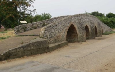
Moulton boasts a four-arched 15th Century Packhorse bridge which spans the River Linnet. Built of flint and stone it is narrow and the parapets are intentionally low to allow goods, such as corn, cloth, poultry, fish, salt and hops, to overhang…
Clare Walk
This 4 mile walk circles the town of Clare taking in the Common, which is the site of the fledgling village some 1000 years ago. The route can be followed on Ordnance Survey Explorer Map 210 Newmarket & Haverhill.
The Denham Big Skies Walk
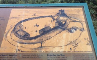
This is a walk for those who enjoy open countryside and big skies. It starts with much field edge walking but rewards come later with the skirting of Denham Castle mound and a return through a deer farm…
Walk to Easter Wood and back
The whole walk is about 5 miles and will take 2 to 3 hours. Ordnance Survey map 210 Newmarket and Haverhill will provide reassurance. The route can be tackled any time of the year being mainly green lanes and field edge paths but the cross-field path can be sticky after rain
Walk to Cowlinge and back
Following this route and walking at gentle pace, from Wickhambrook to Cowlinge will take around 90 minutes. There are several options for the return journey…
A Kedington Hills Circuit
There used to be a newspaper cutting on display in the porch of Kedington church which read – ‘Sir, I note the correspondence regarding a proper Christian response to bats in the spire. As the incumbent of a typical Anglican parish, I can assure you that the only answer is to get the bats baptised and confirmed. In my experience, you will never see them again’. This has now been removed but the church is well worth a visit. This can be at the start or end of this 5.5 mile walk around the hills of Kedington area…
Stetchworth walk
The Devils Dyke is one of the best preserved Anglo-Saxon earthworks in England. Thought to have been built by the Saxons in the 6th and 7th centuries AD to keep those Britons at bay, the bank and ditch stretches for 7.5 miles between Reach and Wood Ditton…
Stanstead Walk
This walk has the distinction of going through the area of the highest point in Suffolk. This is supposed to be in Stanstead Great Wood but this does not agree with the contours on the Explorer 196 Sudbury, Hadleigh and Dedham Vale Ordnance Survey map which show a higher point to the west. The circuit also takes you down part of the drive and through the grounds of Kentwell Hall. The distance is almost 7 miles…
Lidgate Walk
This pleasant 4-mile circuit starts from Lidgate and makes use of hilltop footpaths to reach the hamlet of Upend. The return journey is mostly along a Quiet Lane. The newly opened permissive path around Lidgate Castle mound and the site of Lidgate Mere is included in these directions. Walking is good all year round…
A short circuit of Stansfield
This 3 mile walk should take about 75 minutes but includes a few hills and as a result several rewarding views. It could be suitable for a summer’s evening…
Barrow Walk
This Barrow walk has sweeping views in all directions and a choice of distances between 4.5 miles and 7 miles…
Skirt the grounds of Denston Hall
This is a shorter walk than normal and has the added advantages of being local and has no stiles. Total distance is 3 miles and at gentle pace it is unlikely to take longer than 2 hours. Maybe an outing for a summer’s evening?
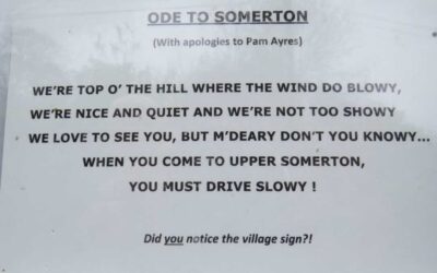
Hawkedon and Upper Somerton Walk
Having travelled almost every footpath in Wickhambrook and several over the parish boundary it is now time to move further afield. This is the first of a series of wanders based on neighbouring villages – those within a 10 mile radius of Wickhambrook. Hawkedon and Somerton circular walk…
Stoke-by-Clare Walk
This 5 mile circular route takes you along both sides of the Stour valley making use of footpaths and quiet country roads. There is a leaflet for an ‘official’ Stoke-by-Clare circular walk but should you choose to follow that you should know that the south most loop (in the grounds of Stoke College) has been shut off. This walk follows part of the ‘official’ route…
Kirtling Shorter Walk
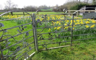
Kirtling is an attractive village on the Suffolk/Cambridge border about 5 miles from Wickhambrook. This walk of some 3 miles can be undertaken any time of the year but there is one stretch along a vehicle track that can become puddled in the shooting season after heavy rain. The route, shown on OS Explorer map 210 Newmarket & Haverhill, follows the edge of Lucy Wood and then skirts the grounds of Kirtling Towers. The grounds are particularly rewarding when the daffodils are in bloom.
Hit the heights of Hartest Walk
Hartest is one of these ‘ideal’ villages with a church, mansion, pub and cottages all huddled round a green and a brook. This five mile circuit goes from the village centre to Boxted then back offering impressive views over the valley and surrounding countryside. The whole distance will take between 2.5 and 3 hours to complete. At most times of the year surfaces underfoot are reasonable but it is best to avoid too strong a wind. The map needed is Ordnance Survey Explorer 211 (Bury St Edmunds and Stowmarket)…
Walk around the Thurlows and Little Bradley
This 3.7 mile circuit runs from Great Thurlow to Little Bradley and back alongside the River Stour. There is a choice of routes for the last half mile but these directions give the ‘high street’ alternative which takes in several interesting buildings such as the Olde School built in 1614 by Sir Stephen Soame (one time Lord Mayor of London) to provide free education to sons of local farmers who were taught ‘English, Latin and Ciphering ’(arithmetic). ..
Brockley Circuit
This is a circular route around the village of Brockley and has the proud distinction of never visiting the village of Brockley. The 7 mile circuit makes use of the Bury St Edmunds to Clare long distance walk in the north/south direction and an old green lane cum bridleway in the south/north direction. There are sufficient undulations and views and variation to make life interesting without providing too much of a struggle. Most of the circuit is either on field edges, or tracks, or through grassy meadows or bridleways but there is one short cross-field section towards the end. In the middle of January this was very sticky. For reassurance take your copy of Ordnance Survey Explorer map 211 Bury St Edmunds and Stowmarket with you…
Hargrave and Chevington
The walk explores the countryside around and between the two villages making use of mainly field edge paths and quiet country roads. There are some gentle slopes and the circuit is a mix of wide open spaces and village edges. At almost 7 miles it is a longer walk than usual but when you reach the seats in Chevington churchyard you are more than halfway round…
Whepstead Wander
This five mile circuit, two and a half hours of walking at gentle pace, makes use of a stretch of the Bury St Edmunds to Clare path and includes two short sections across fields but the route is regularly walked so they should be clear of crops and accessible all year round…
Denston Walk
This route will take you there and back in under three hours at leisurely pace. Most of the circuit is on field edge paths or minor roads with pavements. There is a seat outside the church that almost overlooks the village green. Please note that on one section of the return journey the path has been diverted and is not as shown on even the most recent copy of the Ordnance Survey Newmarket and Haverhill 210 Explorer map, but it is clearly waymarked…
Longer circuit of Stansfield and Denston
This 7 kilometre circuit (4.5 miles) will take about 2 hours at normal pace. The route goes along each side of the River Glem valley giving good views in most directions and passes one of the Landmark properties…
Dalham Walk
This is one of the most attractive local walks within easy reach of Wickhambrook (15 minutes by car) and samples the woods, hills and cottages of Dalham Hall estate. There is a possibility of refreshment on the 4.5 mile circuit providing you check beforehand…
Walk from Chevington to Wickhambrook
If you fancy a change from circular routes why not use public transport to visit a neighbouring village and walk back home. This is one possibility. The route includes a short section along a potentially busy road and a hi-vis jacket is a wise precaution…
Kirtling Longer Walk
Kirtling is an attractive village on the Suffolk/Cambridge borders. This walk is made up of two loops – a leg stretch of about 5 miles, which includes walking along the bed of a stream, and a more built-up loop of 1.5 miles with an optional visit to the church and good views of Kirtling Towers…
Ousden Return
A Walk from Wickhambrook to Ousden (and maybe the ‘Fox’) and back. This circuit of almost eight miles and three hours walking is possible in winter, most underfoot surfaces are green lanes or minor roads, but could be more enjoyable and relaxing during the spring to autumn period. Take Ordnance Survey Explorer map 210 covering Newmarket and Haverhill as your companion…
Stansfield South & Assington Green Walk
This circuit is around five miles and takes two and a half hours of steady walking. You join the Bury to Clare route for a short distance, pass the Stansfield Compasses pub, cross the baby River Glem twice and pass through the small but attractive village of Assington Green…
Walk to the CHERRY TREE and onwards
This is one of several walks to neighbouring pubs and it can be a ‘there and back’ exercise (a mildly interesting 4½ miles) or it can be extended to take in Denston (a more rewarding 7 miles)…
Cheveley and Ashley Walk
This 6 mile circuit makes use of well maintained paths around some of the Newmarket studs, quiet country roads and a section of the Icknield Way, supposedly the oldest road in Britain. The latter was already ancient when the Romans came and extends from Ivinghoe Beacon in Buckinghamshire to Knettishall Heath in Norfolk along the chalk ‘spine’ of England. This local walk can be enjoyed during the winter period.
Wickhambrook walk including Baxters Green
This circular walk heads north of the village and makes use of the green lanes in that area. Total mileage is between 6 miles and 7 miles and will take around three hours at gentle pace. The circuit is best undertaken in the drier months. It is also enjoyable in the winter, just a bit more of a challenge. For reassurance take Explorer map 210 Newmarket & Haverhill with you…
Walk around Wickhambrook
This walk around Wickhambrook was first published in April 2005 and was the first of, what eventually became, many circular walks in the village and surrounding area. At reasonable pace this one takes around 3 hours and covers about 5 miles…
Wickhambrook Walk
This is the third of a series of local walks being prepared for the Discover Suffolk leaflet. The route sticks mainly to the village centre but includes some countryside stretches, which can be muddy in winter, and four short sections of road…
A Hundon Walk
This route which takes you from Hundon to Poslingford and back is just over five miles and if you wish for a picnic midway there are several seats in Poslingford churchyard. The walk is one of undulating contrasts with one particularly long cross-field path which should be clearly indicated, good views and several short sections of great interest. Enjoy…
Hawkedon Circular Walk
The Hawkedon website states ‘Hawkedon is one of the strangest places in Suffolk. There’s nowhere else quite like it. Here, in the rolling landscape between Haverhill and Bury, is where the Chiltern Hills come to die. On their journey through Bedfordshire and Essex they become lower and softer, with the occasional last stabs of glory before sinking beneath the Suffolk heathlands…
Depden Tower Walk
No circular walk this time but a bus journey to Depden water tower and then a wander back to Wickhambrook across the fields. The journey incorporates several stiles, a risky crossing of the A143, a downhill stroll beside five lakes and a skirting of the grounds of Denston Hall. Total distance is about 8 miles but it is all easy walking and can be covered comfortably in three hours…
Wickhambrook plus Clopton & Denston
This circular walk heads east to Clopton Green, south to Denston and returns along the brook valley making use of field edge footpaths and quiet country roads. There are two steady climbs but the effort is rewarded by pleasing views of rolling Suffolk countryside. Most footpaths are regularly cut and the whole circuit is as shown on the local Ordnance Survey map – Explorer 210 Newmarket & Haverhill. Waymarks are not being replaced currently because of budget restrictions so it is advisable to take a map or some other mapping aid with you. The walk is approaching seven miles so you may wish to pack a picnic…

