
Cross the flint bridges of Moulton
Moulton boasts a four-arched 15th Century Packhorse bridge which spans the River Linnet. Built of flint and stone it is narrow and the parapets are intentionally low to allow goods, such as corn, cloth, poultry, fish, salt and hops, to overhang. The bridge was on a major route between Bury and Cambridge. Pack horse trains could number up to 50 animals and were the main long-distance transport in this part of the country up to the 18th century.
The walk includes both this bridge (the climb is surprisingly steep) and an easier pedestrian version just along the river. The whole circuit, shown on OS Explorer Map 210 Newmarket & Haverhill, will take two hours without stopping. Start with a flat section alongside the river, which is often hidden, climb the hill to Gazeley, then travel along a ridge before dropping back to Moulton. Seats can be found half way round in Gazeley and just above Moulton church. The side door of the lofty, light and spacious St Peter’s church is sometimes unlocked; if not, the keyholders can be found nearby. New Moulton Stores is regularly open and offers tea, coffee and fresh bakery items.
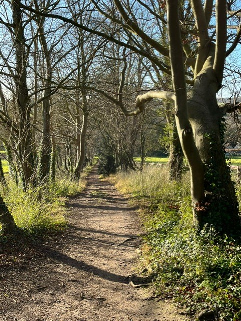
Park in the village hall car park. This is not the largest car park in Suffolk and if you are unlucky enough to clash with a hall function there is an alternative area just below the church. Let’s assume that you are in luck. Go through the gate to the right of the Hall into the playing fields. Bear half left, avoiding the swings, and go through another gate to leave the recreation area. Continue ahead to follow the track beside flint cottages until reaching the river (more of a brook really). Turn right and accompany the water until reaching the second bridge, an old flint pedestrian version. Cross this and then follow the river which is now on your right. Pass the ford, the gate to the church and continue in the same direction into a wooded area. Follow the path along the edge of a field into another wooded area. Soon after passing Gazeley water treatment works you will reach a road. Turn left and walk uphill. There is a more interesting alternative of a faint path through the trees on the left but you may need to switch on your inner explorer. The path runs parallel to the road and some twenty paces from it and will reduce the road walking by half. Eventually you will reach the safety of the pavement leading into Gazeley. Pass Munson’s Brewery at the ‘Chequers’ and head into the churchyard. Follow the path that leads left of the church through a kissing gate (without a gate) and find a waymarked footpath leading between hedges and through gates. The path leads out to the open and soon joins the Gazeley to Moulton road at a bend. Veer left and shortly start going downhill. (There appears to be a villager’s path that runs parallel to the road behind the hedge on the left but be aware that this is not an official route) Where the electricity lines cross the road for the second time look for a footpath sign and part stile on the left. Step over this and follow the path leading half right to another stile in the distance. Cross the second stile, and maybe make use of the seat on the left to appreciate the views across the valley. Ely cathedral can be seen on the horizon to the right. Continue in much the same direction to enter a small wood via another stile and go steeply downhill in a tunnel of greenery.
When the church comes into view, instead of going through the gate turn right and follow the narrow path along the edge of a horse paddock. This leads past a new house to a solid wooden fence. If the main gates are closed there is a small pedestrian gate to the left. Continue to the road. Turn left and continue downhill to the packhorse bridge. Having admired this carry on along the road passing the ‘The Packhorse Inn’ to return to the car park.
Walked January 2025
This series of walks have been put together by Roger Medley.
If any of the walking notes are confusing or inaccurate or the information is wrong, please contact Roger on 01440 820551. If they are helpful, or if you have any other comments, likewise.
Coming Soon to a Fingerpost near you
Suffolk County Council has received funding for a county wide initiative to encourage more people to explore the local area. A field officer has been appointed and volunteers have been recruited to attach plaques to fingerposts in individual parishes. Each plaque (see diagram) displays an app. which can be downloaded to modern Apple and android phones. This will display the local section of the Ordnance Survey map showing footpaths and recognised walking, cycling and riding trails. The information can be stored if walkers are visiting an area where there is limited phone cover. Plaques have been added to 44 stable fingerposts in Wickhambrook and where fingerposts are missing or unstable these have been reported. There are 18 of these and they will be replaced complete with plaques. Wickhambrook is one of the first parishes in the County to complete this task.
W.I.Walking Group
The Wickhambrook W.I. Walking Group meets every Wednesday morning at 10am starting from the MSC car park for walks in the village or slightly further afield. We walk for about two hours and cover about five miles, depending on how much chatting is taking place. There are usually six of us, although we have had a dozen occasionally, dogs are welcome too.