A Walk from Wickhambrook to Ousden (and maybe the ‘Fox’) and back.
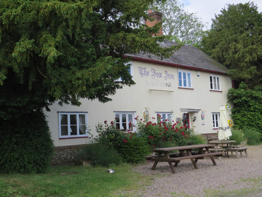
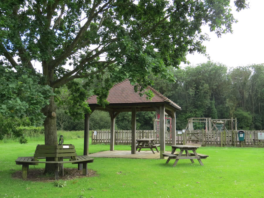
This circuit of almost eight miles and three hours walking is possible in winter, most underfoot surfaces are green lanes or minor roads, but could be more enjoyable and relaxing during the spring to autumn period. Take Ordnance Survey Explorer map 210 covering Newmarket and Haverhill as your companion. The Ousden ‘Fox’ (01638 500740) is open every day from 12 noon to 11.00pm. If you prefer to munch your own sandwiches there is a solid public shelter in Ousden recreation ground.
Starting from the entrance to the Memorial Social Centre car park take the footpath to the right which runs between the Women’s Institute Hall and the Cemetery. This leads across a sleeper bridge and ahead beside an arable field. At the corner turn left and then right on reaching the road. Ignore all possible turnings until you have left the green behind and crossed the bridge (confirmed by the presence of barriers on both sides of the road). This is a nasty stretch of road because visibility is restricted and drivers assume that the road is clear, so care is needed. Take the stile and cross-field footpath on the left (‘dogs on lead’ sign as sheep are often to be found in this field). Follow this track over a culvert then bear right to find another stile in the far hedge. Climb this (both stiles have flaps which can be lifted for less agile pets) and walk ahead with a mature hedge and brook on the right. Go through the hedge gap in the corner and continue in much the same direction drifting away from the brook to skirt a small wood and then returning to meet the brook again. Eventually you enter some trees. At this point there are several large fallen trunks on which you can perch for a coffee break. Cross two wooden bridges and turn right. Follow this sheltered green lane for ¾ mile. You will eventually reach a partially hidden pond to the right and green lane going off to the left but carry straight on (slightly right). Pass Busses Farm and several static animals and join a quiet road. This leads to another road at Newhouse Farm. Continue ahead passing the road junction at Baxter’s Green and on reaching an ‘S’ bend and Queens House look left to find a byway. Take this track until you reach another green lane crossing at the end. Turn right and follow this almost to the end. Just before reaching a garden fence there is a footbridge and a short cross-field footpath on the left. In dry conditions take this path through the crop to the gap in the hedge at the far end and turn right at the road to reach the ‘Fox’ at Ousden. If wet underfoot continue with the green lane to the road then turn left and left again to follow the main road, past the village sign, to the public house.

After suitable refreshment leave the pub (turn right out of the door of the public bar) and go down the road to find the village hall on the left. Enter the recreation ground and follow the perimeter to the right to join a path, right again, to follow the edge of a wood. This is a permissive path and is regularly used by locals. If uneasy about this suggestion continue down the road until you find a fingerpost pointing left opposite a letter box. Take this path up a few steps and continue ahead. From either direction you will reach the corner of the wood and you should turn left (first option) or continue away from the road (second option) to soon pass a large red brick house on the left. Join a hard surface track. This will soon turn left and so should you. After 150 paces ignore the turning and footpath to the right and walk through cottages to reach a proper road. Continue ahead until reaching a Byway sign pointing right along a green lane. Take this. At the far end turn left where this lane joins another. Shortly after passing the entrance to the telecommunications compound look for a green ‘tunnel’ footpath to the right. This short path will lead you into Spring Wood with its plethora of wildlife signs. Walk down the cleared section (stepping over several fallen trees) and through a gap in a collapsing fence to reach a wide grassy track. Follow this until reaching the end of the hedge on the left where a waymark points left. Obey this and continue, now with a hedge on your right, to the far corner where you enter but skirt two sides of a small wood to reach the road. Turn right, go round the bend, and take the footpath to the left before the barrier railings. This path runs beside the hedge on the left and eventually crosses an arable field to return to the narrow wood that you walked along previously. Turn right and follow this track all the way to Coltsfoot Green, and a bench, and the road. Turn right and then take the first footpath on the left (fingerpost on the opposite side of the road). At the end of the field on the right go up the steps and turn right to follow the top of the bank into the recreation ground when the MSC Hall and car park will come into view.
First walked 25th November 2009
Re-walked 13th June 2019
Roger Medley [text-blocks id=”50903″ slug=”roger-medley-tel-no”]
Coming Soon to a Fingerpost near you
Suffolk County Council has received funding for a county wide initiative to encourage more people to explore the local area. A field officer has been appointed and volunteers have been recruited to attach plaques to fingerposts in individual parishes. Each plaque (see diagram) displays an app. which can be downloaded to modern Apple and android phones. This will display the local section of the Ordnance Survey map showing footpaths and recognised walking, cycling and riding trails. The information can be stored if walkers are visiting an area where there is limited phone cover. Plaques have been added to 44 stable fingerposts in Wickhambrook and where fingerposts are missing or unstable these have been reported. There are 18 of these and they will be replaced complete with plaques. Wickhambrook is one of the first parishes in the County to complete this task.
W.I.Walking Group
The Wickhambrook W.I. Walking Group meets every Wednesday morning at 10am starting from the MSC car park for walks in the village or slightly further afield. We walk for about two hours and cover about five miles, depending on how much chatting is taking place. There are usually six of us, although we have had a dozen occasionally, dogs are welcome too.
