
This 3 mile walk should take about 75 minutes but includes a few hills and as a result several rewarding views. It could be suitable for a summer’s evening.
Park at the Village Hall; to be found at the south end of the ‘high street’ next to the playing fields. There is a sign on the road.
Walk through a narrow gap to the left of the front of the hall past the playground and picnic bench to find a slope down to the road. Cross the road and use the pavement to walk downhill in safety. At the bottom of the dip cross the bridge and turn left along a sometimes overgrown footpath. Nettleproof trousers could be advisable at certain times. Follow this shady path through trees and undergrowth until you reach a footpath sign. There is a path going straight on through a gate but ignore this and turn right and walk up a headland with a mature hedge on the right. About halfway up the slope the path veers to the right through the hedge, across a sleeper bridge, up steps and through a gate. Follow this.
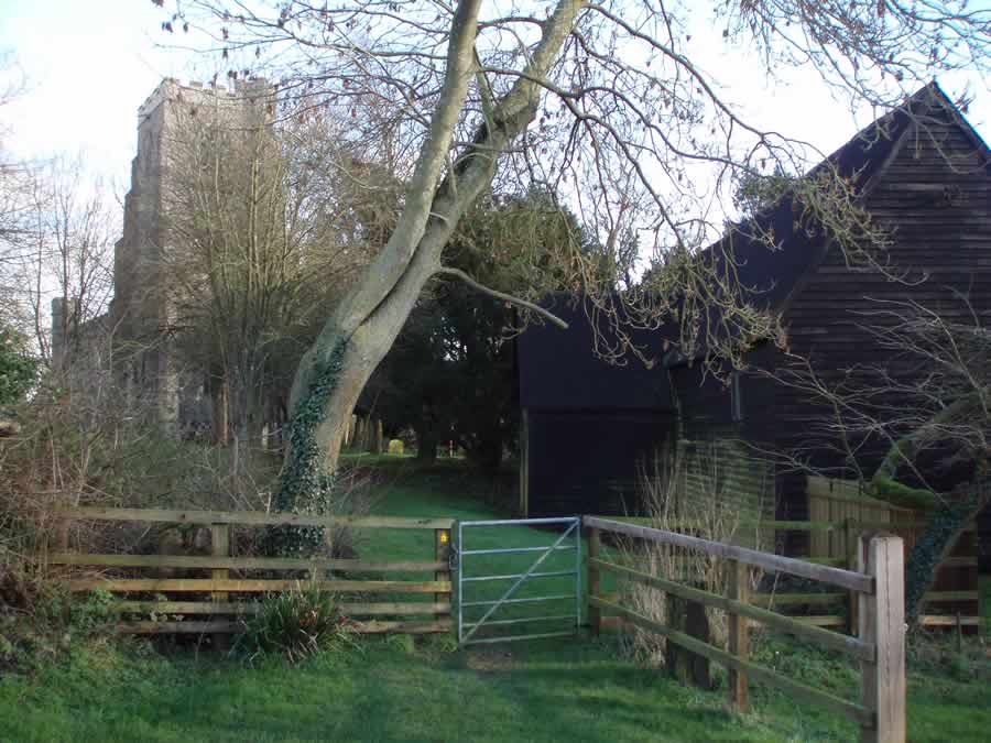
The catch on the post is unusual. Keep to the left of the fir trees and aim left of the barn ahead. Walk in front of the stables. Cross the farm drive heading slightly right to reach a small metal gate. This path takes you through the graveyard (there are seats here) and in front of the church to reach the road. Turn left. There is no pavement so it is best to cross and face any approaching vehicles.
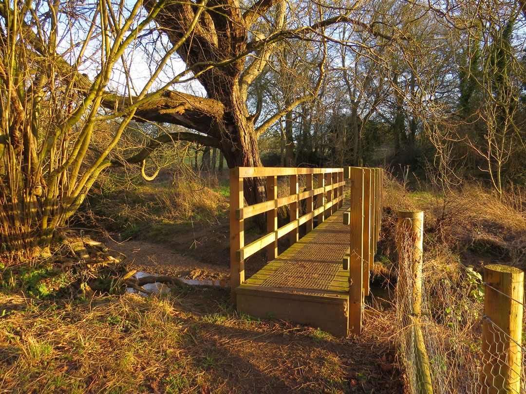
On reaching the top of Plough Hill and the green triangle of grass in the middle of the junction, veer right to find the driveway to Mill House, and a footpath sign. Head towards a decapitated windmill where a five-bar gate appears to halt any progress. On reaching it you will find that the path goes to the left and skirts the garden between wire netting and the hedge. Continue through this narrow space to reach a field beyond. Keeping the hedge on the left enter the next field, and when the hedge turns sharp right, go though the gap on your left to enter a further field. Cross a small arable area, which can be muddy if freshly disturbed, into the next field to return to grassy headland walking. Now with the company of a wood on your right you continue until you reach a corner. There are pleasing views of Hawkedon church and village to the left. Turn right to stay beside the trees. You are funnelled into a corner where you veer right through the hedge across a sleeper bridge and follow the field edge to the left. Go round a corner and at the next corner turn left downhill and follow a wider green path. Ignore the waymark to the right unless you wish to return to the centre of Stansfield. At the valley bottom the track turns sharp left but you must continue ahead and drop down to a wooden bridge. This section is a little bit of Devon.
Continue up the far side keeping to the hedge on the right. Go through the gate or climb the stile beside, cross the road and take the field edge path opposite. Stay with the hedge and ditch on the left, round two sides of this field then into the next. You are now walking a section of the Bury St Edmunds to Clare path which has its own distinct waymarks. At the next field corner go across a sleeper bridge through the hedge and follow, at times, an indistinct path across two narrow fields. If in doubt head for the power lines. On reaching the ‘road’ (two parallel lines of concrete) turn right to return to the village hall.
Roger Medley
Re-walked and updated January 2022
This series of walks have been put together by Roger Medley.
If any of the walking notes are confusing or inaccurate or the information is wrong, please contact Roger on 01440 820551. If they are helpful, or if you have any other comments, likewise.
Coming Soon to a Fingerpost near you
Suffolk County Council has received funding for a county wide initiative to encourage more people to explore the local area. A field officer has been appointed and volunteers have been recruited to attach plaques to fingerposts in individual parishes. Each plaque (see diagram) displays an app. which can be downloaded to modern Apple and android phones. This will display the local section of the Ordnance Survey map showing footpaths and recognised walking, cycling and riding trails. The information can be stored if walkers are visiting an area where there is limited phone cover. Plaques have been added to 44 stable fingerposts in Wickhambrook and where fingerposts are missing or unstable these have been reported. There are 18 of these and they will be replaced complete with plaques. Wickhambrook is one of the first parishes in the County to complete this task.
W.I.Walking Group
The Wickhambrook W.I. Walking Group meets every Wednesday morning at 10am starting from the MSC car park for walks in the village or slightly further afield. We walk for about two hours and cover about five miles, depending on how much chatting is taking place. There are usually six of us, although we have had a dozen occasionally, dogs are welcome too.