This 3.7 mile circuit runs from Great Thurlow to Little Bradley and back alongside the River Stour. There is a choice of routes for the last half mile but these directions give the ‘high street’ alternative which takes in several interesting buildings such as the Olde School built in 1614 by Sir Stephen Soame (one time Lord Mayor of London) to provide free education to sons of local farmers who were taught ‘English, Latin and Ciphering ’(arithmetic). The Ordnance Survey map covering this area is Explorer 210 Newmarket & Haverhill. Target walking time is between 90 and 100 minutes.
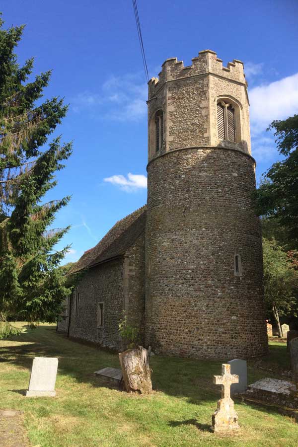
Park at Great Thurlow recreation ground which can be found south of the village on B1061 Haverhill to Newmarket road. Find your way to the far side of the tennis courts and then take the track that runs to the left in front of the dog bin. This leads to the road. Turn right and go over the bridge and after passing Bridge Cottage take the footpath on the left. Go through the lower edge of the cemetery following the waymarks, cross one small paddock (this may contain cattle), a field, and enter a wooded area. In wet weather this next short stretch can be muddy so appropriate footwear is advised. Walk beside the river, ignore the bridge on the left and at a crossroads of footpaths turn right towards a field. Follow the course of a regularly used field edge path left around the sewage works along the concrete access drive eventually reaching the minor road that runs between Thurlow and Stradishall. Turn right and make use of the wide grass verge to reach the houses of Little Thurlow Green. Ignore footpath signs to both the left and right. You then lose most of the verge so care is needed. Just in front of a ‘Single Track Road with Passing Places’ sign make use of a field entrance to walk behind the hedge now on the left. This is a ‘villager’s path’ which runs parallel to the road for a short distance. At the end of the ditch on the left drop down to take the footpath almost opposite and immediately before white barrier rails. Accompany the hedge on the right until you reach a five-bar gate. Go through and continue in much the same direction, being watched by hopeful horses in enclosures, towards the farm buildings. Go through another gate (metal 6-bar) and then take the concrete drive straight ahead through barns and stables. Reach a minor road and turn left. Follow this as it winds through the village of Little Bradley past the attractive round tower flint church. Instructions for obtaining a key are in the porch. Follow the road round to the right and pass several cottages. Cross the bridge over the River Stour and turn left to follow the footpath that runs beside the gently flowing waters. On reaching the road go across (footpath sign) and follow the shingle path that runs though the churchyard. At the fence turn right and left (following the Stour Valley Path) to take a track between paddocks into a small field. Continue ahead to a kissing gate beside the school. Go through and continue until you meet the ‘high street’. Turn left. After 150 paces you will find on the left the Olde School with its imposing entrance. The ground floor, which was the classroom, was designed so that it was not possible to see out of the windows while sitting down. The next building on the left, one of Manor Farms Barns, has a replica of a Wellington bomber on the thatched roof. This is in memory of a Second World War tragedy when a plane trying to reach Chedburgh aerodrome clipped the end of this building and crashed in the field behind killing the New Zealand crew.

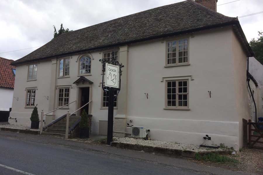
Continue along the road past the ‘Thurlow Cock’ (Open most lunchtimes and evenings), the village hall and the garage until you reach the offset crossroads. Go straight across and in another 100 paces you will find the car park.
Roger Medley
Walked August 2020
This series of walks have been put together by Roger Medley.
If any of the walking notes are confusing or inaccurate or the information is wrong, please contact Roger on 01440 820551. If they are helpful, or if you have any other comments, likewise.
Coming Soon to a Fingerpost near you
Suffolk County Council has received funding for a county wide initiative to encourage more people to explore the local area. A field officer has been appointed and volunteers have been recruited to attach plaques to fingerposts in individual parishes. Each plaque (see diagram) displays an app. which can be downloaded to modern Apple and android phones. This will display the local section of the Ordnance Survey map showing footpaths and recognised walking, cycling and riding trails. The information can be stored if walkers are visiting an area where there is limited phone cover. Plaques have been added to 44 stable fingerposts in Wickhambrook and where fingerposts are missing or unstable these have been reported. There are 18 of these and they will be replaced complete with plaques. Wickhambrook is one of the first parishes in the County to complete this task.
W.I.Walking Group
The Wickhambrook W.I. Walking Group meets every Wednesday morning at 10am starting from the MSC car park for walks in the village or slightly further afield. We walk for about two hours and cover about five miles, depending on how much chatting is taking place. There are usually six of us, although we have had a dozen occasionally, dogs are welcome too.
