This five mile circuit, two and a half hours of walking at gentle pace, makes use of a stretch of the Bury St Edmunds to Clare path and includes two short sections across fields but the route is regularly walked so they should be clear of crops and accessible all year round. There is a small amount of quiet road walking but pavements or verges are available along most of the distance. Most walking is done on field edge paths. Take Ordnance Survey Explorer 211 map (Bury St Edmunds & Stowmarket) with you for re-assurance.
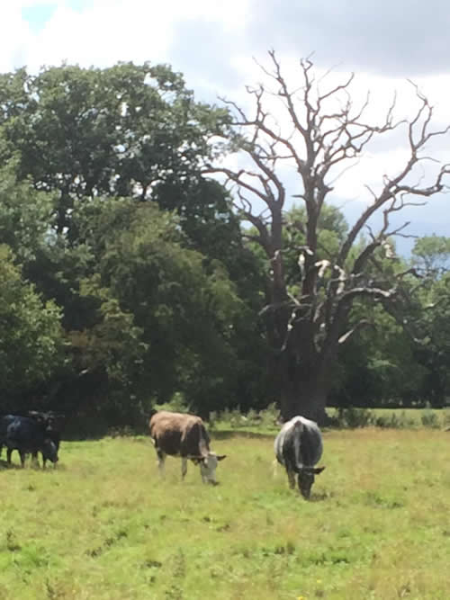
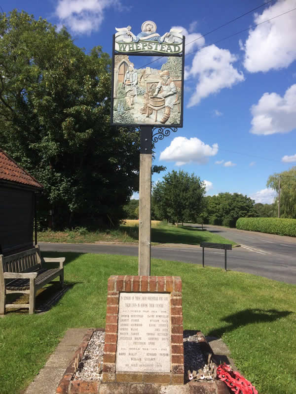
Park at the Whepstead Community Centre on the Bury to Hartest road. Pick up the pavement on the left as you leave the car park and follow the road through houses, passing the village sign on the right and the old school on the left. Continue to the bottom of the dip where you will find a footpath sign indicating the Bury to Clare walk. Climb the bank on the right and follow a field edge path until you reach a waymark and wooden footbridge on the left, shortly after a corner. Cross the bridge and continue ahead at first beside a hedge and then across a field (heading to the left of a dead tree). At the far side turn left (waymark) to accompany another hedge and follow that around a corner. Cross a sleeper bridge into a second field. Continue and then go through a hedge gap into another field. Ignore the option to the left and continue ahead. The right of way is usually obvious but in the absence of any indication you are heading to the right of a clump of tall poplar trees. At the far side you will find a vehicle track and a footbridge. Ignore the footbridge and stay with track as it heads left. This comes to an open area and then turns right. Leave the track at this point and continue ahead across a grassy area. The wood should remain on your right throughout. Enter a narrow green path between large oak trees where you will find a reassuring Bury to Clare waymark. Continue along this most pleasant section to find another open, then wooded area. You will soon find a footpath sign and a sleeper bridge on your left and here you leave the long-distance path. Cross the bridge to pick up a headland footpath with a hedge on the right. After a while you should change sides (waymark) so the hedge is now on your left. Cross a sleeper bridge (not easy to spot) just before the field corner and continue to the right. (Locals seem to continue ahead around an oak tree but that is not the right of way). The footpath almost reaches the road but turns left and runs alongside the hedge remaining inside the field. Obey a waymark pointing through a gap in the hedge (Please Note: this is easily missed and is midway between two oak trees standing in opposing field corners) and go down two steps and over a sleeper bridge to find a track. Cross the track and continue ahead on the field edge running parallel to the road. Soon you will cut across a corner, and then reach a fingerpost. Go straight across the road (there was no waymark to be seen in July 2020 but this is the right of way) into the field opposite, and follow the headland left to cut that corner off. Drop down to join Tuffields Road and turn right. Soon after a right-hand curve in the road, you will see a footpath sign and a stile on the left. Climb the stile and cross a grazing meadow with the atmospheric Manston Hall on the right. Follow the direction indicated by the fingerpost heading just to the right of a veteran oak tree. A waymark on the edge of a ditch will tell you that you are in the correct place.

Continue in much the same direction to reach the far-right corner and another, rather wonky, stile. Climb this and turn left to join a field edge footpath that dog-legs for some way. Eventually, after passing a row of poplars, you will reach a right-hand corner containing a post but no waymark. Continue for a further short distance on the field edge to pass some farm buildings. Turn left after the last of these, a large asbestos barn, and before reaching a five-bar gate. This narrow, enclosed path leads to the road where you turn left. Make use of the verges to pass Hawkes Farm and an unmarked Riches Farm both on the left and obey the next fingerpost on the left indicating that you are back on the Bury to Clare walk. Follow the path, which is regularly waymarked, beside a paddock, through a clearing (home to some unloved farm machinery), beside a field, then turning right through a gap in the hedge to find another paddock. Follow the post and rail fence on the right past a five-bar gate and into a sharp corner where another waymark will guide you across a footbridge into the next field. Turn left to follow the perimeter of the field and continue with the headland. At the far end of this field you will reach the B1066 road at the point opposite to where you originally joined the Bury to Clare walk. Turn right and head back towards the Community Centre.
If you have energy left take the footpath on the left which goes down the back of an impressive garden to a little pumping station in the valley. This is an extra 20 minute loop. Just beyond the pumping station and before you join the road turn right to take a path behind a hedge (there is a notice saying ‘Pedestrians only’) leading uphill. This stays beside the hedge and leads to the church of St Petronilla’s. The dedication to St Petronilla is thought to be unique in parish churches and there is some uncertainty as to whom St Petronilla really was. There is a tradition that she was a Roman serving girl, sometimes referred to as St Peter’s daughter and often depicted in pictures holding a key for him. The church had a spire until 1658 but it fell in a great storm the night Oliver Cromwell died. The church is usually closed but the phone numbers of the key holders are in the porch. Continue to reach the main road and turn left to reach your start point.
Roger Medley walked 16 March 2014
Re-walked July 2020
If these notes are confusing or inaccurate or the information is wrong, please let me know. If they are helpful, or if you have any other comments, likewise.
Roger Medley [text-blocks id=”50903″ slug=”roger-medley-tel-no”]
Coming Soon to a Fingerpost near you
Suffolk County Council has received funding for a county wide initiative to encourage more people to explore the local area. A field officer has been appointed and volunteers have been recruited to attach plaques to fingerposts in individual parishes. Each plaque (see diagram) displays an app. which can be downloaded to modern Apple and android phones. This will display the local section of the Ordnance Survey map showing footpaths and recognised walking, cycling and riding trails. The information can be stored if walkers are visiting an area where there is limited phone cover. Plaques have been added to 44 stable fingerposts in Wickhambrook and where fingerposts are missing or unstable these have been reported. There are 18 of these and they will be replaced complete with plaques. Wickhambrook is one of the first parishes in the County to complete this task.
W.I.Walking Group
The Wickhambrook W.I. Walking Group meets every Wednesday morning at 10am starting from the MSC car park for walks in the village or slightly further afield. We walk for about two hours and cover about five miles, depending on how much chatting is taking place. There are usually six of us, although we have had a dozen occasionally, dogs are welcome too.
